NEW Interactive NTRIP State Network Map — find your state's RTK access Open Tool →
Workforce development for modern surveyors

Become the surveyor
the industry needs.

Drones, GNSS, CAD, geodetics, exam prep — taught hands-on by practicing surveyors. Join 0+ members across four continents.

See the community
JTMRKSAL
Joined by surveyors from 4 continents · new lectures every week
What we teach
Drone mappingGNSS & GPSCAD & Civil 3DGeodeticsBoundary surveyingFS exam prepPS exam prepNTRIP & RTK
The classroom is the field

Built around real work.

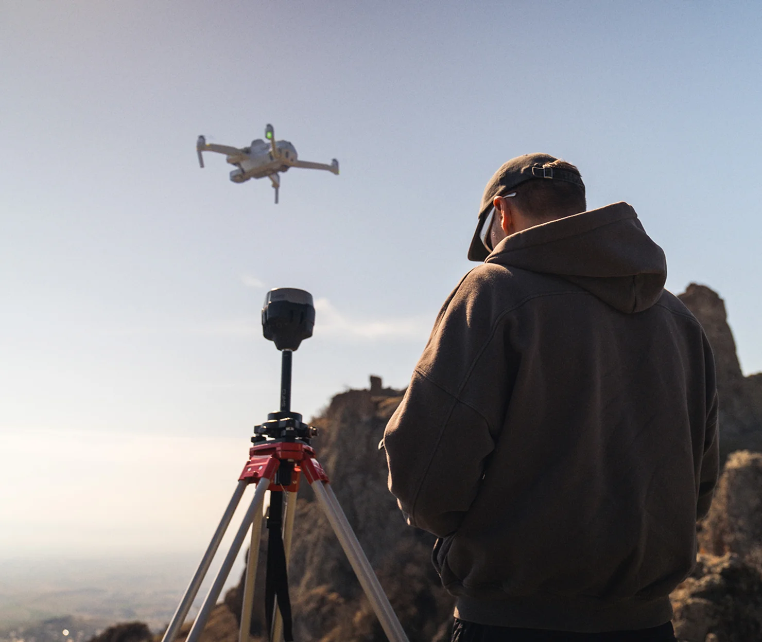
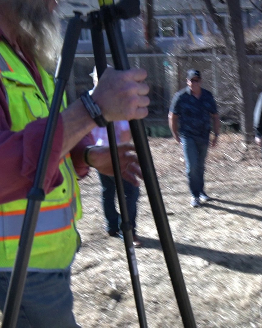
Most surveying education is theory in a classroom. Ours starts with GNSS rovers , drones , and total stations in your hands the first week guided by surveyors who use them every day. You learn the workflow that ships, not the workflow in a textbook.

Hands-on instrumentsReal job sitesModern softwarePracticing instructors
GNSS rover on a tripod
Drone landing pad with rod
Members in the school van
Instructor teaching at a tripod
The curriculum

What you'll master.

Every track is taught by working surveyors and updated as the field changes. New lectures every week.

Drone mapping & photogrammetry

From flight planning and photo capture through Pix4D / WebODM processing. Build orthomosaics and point clouds clients actually pay for.

GNSS, RTK & NTRIP

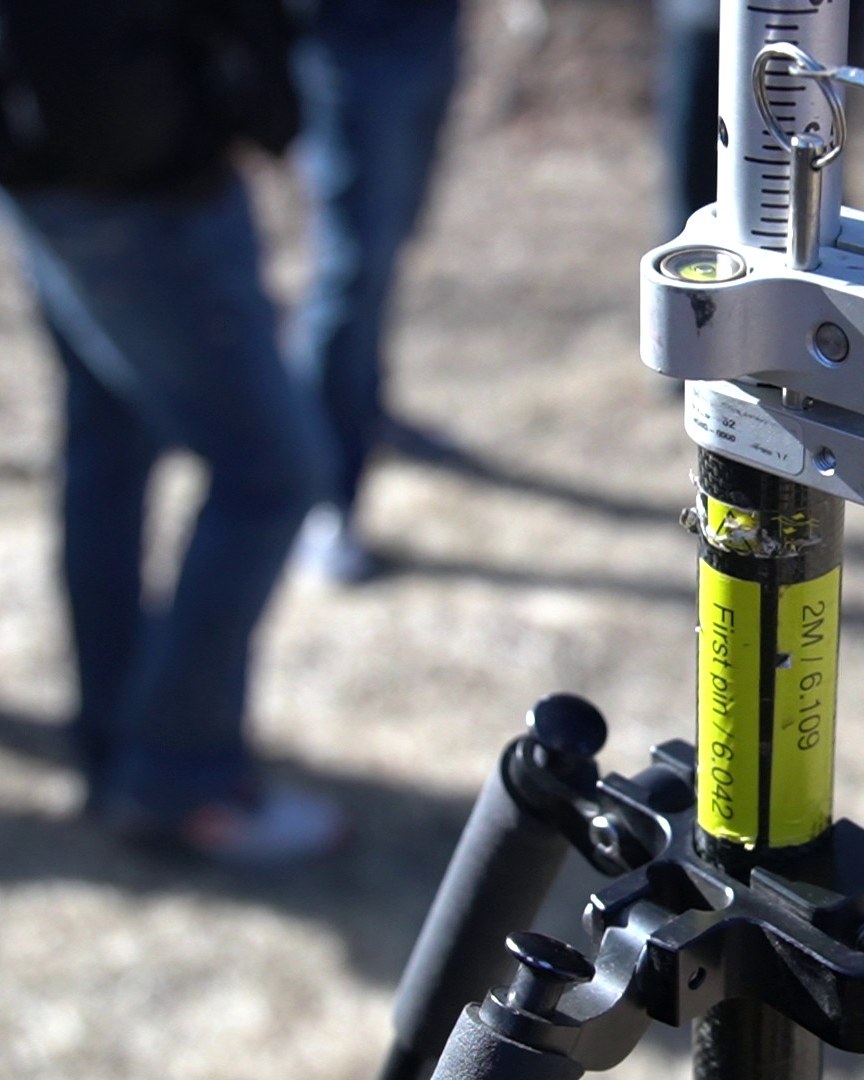
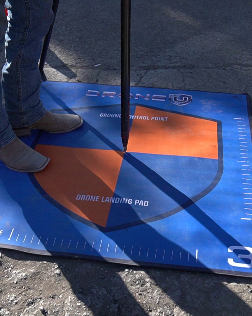
How GPS actually works, how to set up a base/rover, and how to find the right CORS network for any state in the country.

CAD & Civil 3D

Production-grade drawing in AutoCAD and Civil 3D. Boundary, topo, and ALTA surveys ready for stamp.

Geodetics & datums

NAD83, WGS84, projections, ellipsoids, geoid models. The math underneath every coordinate you publish.

FS & PS exam prep

Every NCEES topic for both exams. Interactive lessons + worked examples free to read; Practice Exam questions need a free email signup.

Field instruments

Total stations, theodolites, levels, and the modern GNSS rovers replacing them. Hands-on workflows, not manuals.

Member perks

The hardware and software
we put in your hands.

When you level up in the community, the tools level up with you. Real software licenses. Real hardware. Shipped to your door.

Pix4D product
UNLOCKS AT LEVEL 6
Pix4D logoFeatured partner

Free 12-month Pix4Dmatic Pro + Pix4Dcatch Pro

Production-grade photogrammetry on the same software shop drone-survey firms run. Process orthomosaics, point clouds, and digital terrain models — no per-project fees.

Visit Pix4D
Emlid product
UNLOCKS AT LEVEL 7
Emlid logoFeatured partner

Free Emlid GNSS receiver

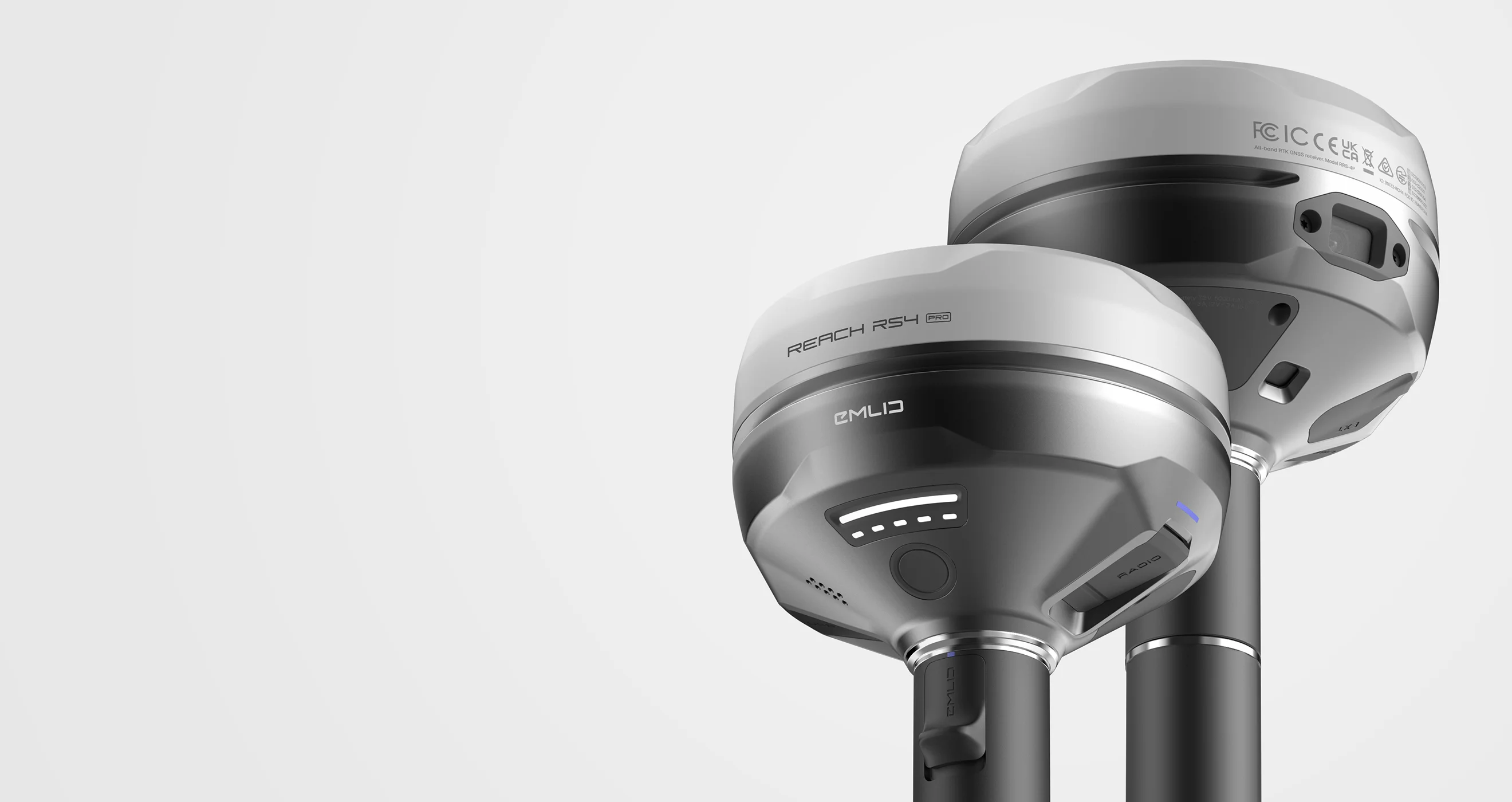
A real RTK rover shipped to your door — the same hardware professional surveyors run in the field. Pair it with any state CORS network and start collecting centimeter-grade data.

Visit Emlid
Why this works

We don't teach you to take a test. We teach you to do the job.

Most members come to us because the path into surveying is broken — outdated curriculums, overpriced exam prep, no community. We rebuilt it.

See it in motion

Real members. Real footage.

No actors, no stock footage. Every clip is from a recent in-person event with the community.

Day 1 of Geo Week 2026 · members on site
Field day — Denver, Colorado
Walking through a real survey workflow
Hands-on instruction with the crew
From the community

Real conversations,
real members.

Three unedited moments from our 2026 in-person field day in Denver. Click any clip to hear the full conversation.

Two members talking shop in the field
Gross is the big number — without expenses. Net is after expenses.
On benchmarking against the industry
Some of it is just benchmarking where I am today — looking around at other experts and professionals, engineering firms, survey firms, the manufacturers. What is the latest and greatest in the technology?
On the barriers we exist to break
They understand everything that goes along with it, but because they can’t do that one math course, all of a sudden they can’t move ahead. There’s just unnecessary barriers.
30-second quiz

Find your path.

Answer four quick questions and we'll point you to the right starting point — free resources, exam prep, or the full program.

What's your name?

So we can personalize your experience.

We respect your privacy. Unsubscribe anytime.

Survey School members laughing together at the 2026 field day in Denver
About

Built by surveyors, for surveyors.

The Survey School is the #1 surveying workforce development community in the world. We teach modern surveying methods — from drone mapping and CAD to GNSS and geodetics — through hands-on courses updated every week.

Members earn XP, level up, and unlock professional software, hardware, and conference passes. Whether you're brand new or a seasoned PLS chasing new technology, this is your crew.

0+
active members in the community
The team

Meet your instructors.

Practicing surveyors who teach the way they wish they'd been taught — modern, hands-on, never boring.

Rami Tamimi, P.S.
Founder · Lead instructor

Rami Tamimi, P.S.

Professional Surveyor and PhD Candidate in Geodetic Engineering at The Ohio State University. Decade-plus of land development experience plus three years tuning sensor alignment for self-driving systems. Teaches the modern stack — LiDAR, drones, photogrammetry — without losing the survey-grade fundamentals.

  • Professional Surveyor (P.S.)
  • PhD Candidate · Geodetic Engineering, OSU
  • Founder of The Survey School
Sample lecture
On the four pillars of modern surveying
Joe Nelson, PLS
Land Surveying Instructor

Joe Nelson, PLS

Project Manager at BKF Engineers with 14 years of professional surveying. Teaches the production-grade workflow — boundary, topo, ALTA, control networks, and final maps ready for stamp.

  • Licensed Professional Land Surveyor
  • 14+ years field & project management
  • ALTA · boundary · topo specialist
Dr. Joseph Kerski, PhD GISP
Geospatial & GIS Instructor

Dr. Joseph Kerski, PhD GISP

Geographer and GIS educator with three degrees in geography and 22 years across NOAA, Census, and USGS. Author of 12 books and 2 TED Talks. Teaches the spatial-thinking foundation that turns coordinates into decisions.

  • PhD Geography · GISP certified
  • Author, 12 books · 2 TED Talks
  • Former Esri Education Manager
Sample lecture
Welcoming you to GIS for Surveyors

Not sure where to start?

Take the 30-second quiz and we'll match you with the right program — free resource, exam prep, or the full community.

Frequently Asked Questions

Not at all. We teach from absolute zero. We have complete beginners, drone pilots, construction workers, and career changers all succeeding together.
The program is designed for people with full-time jobs. 30 minutes a day is enough to make real progress. Lectures are recorded and rewatchable any time.
Membership is hosted on Skool — pick your tier on the plans page and you get instant access to the community, classroom, weekly live sessions, and the curriculum.
Not at all. We have members across four continents. Surveying fundamentals (geodetics, GNSS, photogrammetry) are universal. State-specific content (US licensing paths, NTRIP networks) is clearly marked so you can skip what doesn't apply.
Premium members at level 6 unlock free 12-month licenses to Pix4Dmatic Pro and Pix4Dcatch Pro. At level 7, you receive a free Emlid GNSS receiver shipped to your door. The full perk list grows as we add partners.
Yes. Rami is a Professional Surveyor and PhD candidate in Geodetic Engineering at Ohio State. Joe Nelson is a PLS and Project Manager at BKF Engineers with 14+ years of field experience. Joseph Kerski has a PhD in Geography and was the Education Manager at Esri. We don't hire content creators — we hire people who do the work.
Yes. Our free Drone Surveying mini-course and the NTRIP State Network Map are both available — drop your email on the Free Resources section and the video unlocks instantly.
Yes. We offer team licenses for surveying firms, DOTs, and contractors. The team account includes everything in the individual membership plus a private group for your crew. Reach out via the contact form for pricing.
Standalone exam prep tracks for the FS and PS licensing exams are in development. Membership today includes the foundational geodetics, math, and field practice that show up on those exams. We'll announce the standalone prep tracks the moment they're ready.
Yes. All Skool subscriptions cancel with one click. No contracts, no hoops, no hidden fees. You keep access through the end of your billing period.
New lectures every week. Existing courses get updates whenever a tool, workflow, or regulation meaningfully changes — surveying is a moving target and the curriculum keeps up.
Both. Recorded lectures cover the curriculum at your pace. Weekly live Q&A and Office Hours sessions are where you can ask the instructors anything — your survey, your data, your stuck point. Members also help each other in the community feed.